Crash injuries in Boston have risen, according to the city’s most recent data, as have fatalities. Some of the city’s most dangerous streets and intersections have remained the same, while other areas saw a change in either direction.
The intersection at Massachusetts Avenue and Melnea Cass Boulevard (Mass and Cass) has remained an area reporting a high number of injuries.
The city’s data, however, does suggest that a change is occurring with fewer pedestrian crashes compared to the year prior. Motor vehicle and bicyclist injuries have largely made up the difference.
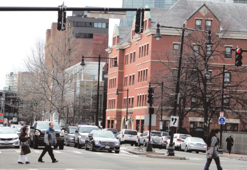
The
length of Massachusetts Avenue remains a dangerous stretch in the city,
seeing nearly 50 accidents between the Charles River and Boston Street.
The
city tracks crash and fatality data through the Vision Zero Boston
initiative, which ultimately aims to eliminate fatal crashes by the year
2030.
Dartmouth
Street in Back Bay was a dangerous stretch for pedestrians at its many
intersections for those 12 months between June 30 2022-2023 but saw very
few the following year. Clarendon Street, only one street over, saw
five pedestrian and cyclist involved crashes 2023-2024, making up the
difference almost entirely.
Downtown
saw less motor vehicle injuries around City Hall Plaza but suffered
from numerous pedestrian and cyclist injuries around the plaza as well
as the many streets surrounding Downtown Crossing.
With
few and relatively evenly distributed pedestrian and bicyclist crashes
outside of Cambridge Street, Beacon Hill remains a relatively safe
neighborhood. On Cambridge Street, the three block stretch between
Garden Street and Joy Street saw eight crashes in that 12-month period,
three of which were cyclist crashes, and one was a pedestrian crash.
Motor
Vehicle injuries occurred evenly throughout the city, and fewer than
the year before. North Washington Street was a standout compared to the
previous year.
Washington
Street between Mass and Cass saw a high concentration of crashes with
four pedestrian, two cyclist and three motor vehicle injuries.
June
30, 2024, is the most recent update of the crash dataset. A
spokesperson for the city said that they receive the data from Boston
EMS and did not know when more recent data would be available. The data
represents only crashes that required a public safety response.
According
to the city’s website, “Records are typically updated on a monthly
basis, but because the verification process involves manual confirmation
of incidents, exact posting schedules may vary.”
Using
June 30 as a year over year marker, 3,453 crash related injuries and 14
fatalities were reported between 2023 and 2024. 3,412 injuries and
seven fatalities were reported between 2022 and 2023.
While
there is a disproportionate number of motor accidents in the city
compared to cyclist and pedestrians, motor vehicle crashes resulted in
far fewer fatalities.
Pedestrian and motor vehicle crashes were both down compared to the year before, while bicyclist crashes increase by nearly 90.
Of
the 14 fatalities in 2023-2024, nine were pedestrian crashes and one
was a bicyclist crash. Fatalities around the city were also evenly
distributed around the city While the city does not have crash data for
2024 past June 30, it has logged fatality data
through
September 2 adding three additional fatalities and bringing the total
for 2024 to 10. All three of those more recent fatalities were
pedestrians The crash data is just one input that the city uses to help
prioritize where projects are done, officials said in an email. They
factor in such things as proximity to schools, whether it is on a
priority bus route, if it is an important missing segment in the bike
network and if it was a project identified in Go Boston 2030.
“The
crash data can help us determine where crashes have happened in the
past, but we use other tools for making decisions about signal timing,”
officials wrote in response to a question about how they are able to
make these decisions using nearly six-month-old data. “For example, we
do traffic counts at peak and non-peak hours during the day, including
turning movement counts, and we do traffic modeling to look at signals
along a corridor to synchronize them to improve traffic flow.”
