The City of Boston is asking the public to submit reports of flooding events through a survey to better determine where it occurs.
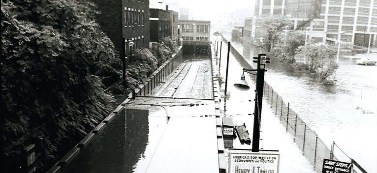
Whether it’s standing water on a road, a puddle on a sidewalk or a river overtopping, flood Fenway Greenway station in 1966 spotters are being told. If you see something, say something.
The
aim, according to the city’s Office of Green Infrastructure, is to use
the information collected from the survey to help identify and
prioritize locations that need green infrastructure like constructions
of plants, soils and other natural materials that capture water.
Those
green infrastructure pieces, such as bioswales and rain gardens, are
designed to allow water to be absorbed back into the ground. That’s in
contrast to how water runs off impervious surfaces like roads and
sidewalks until it reaches a drain or catch basin.
The
city’s storm drains are designed to handle 5 inches of rain runoff
across a period of 24 hours, according to Kate England, Boston’s
inaugural director of green infrastructure.
But as the climate has continued to change, Boston has experienced more rain and heavier storms.
In
recent years, storms have dropped 1 to 2 inches of rain in just an
hour, and the stormwater system isn’t big enough to manage that amount
of water at once, England said. The result is flooding.
One
neighborhood at particular risk of flooding is the Back Bay, according
to Michael McCord, head of the Neighborhood Association of the Back
Bay’s Green Committee, who said filling out the survey is a “small thing
that people can do, but an important thing.” That the area’s sewer
system gets overwhelmed during heavy rainstorms is “an early indicator
of the Back Bay’s inability to deal effectively with torrential rains,”
McCord said.
The neighborhood also abuts the Charles River, which could overflow its banks.
“I
think with the combination of rising tides from global warming and the
impact of horrendously huge rainstorms that we’re seeing from global
warming, the Back Bay is pretty vulnerable,” McCord said.
More
than $450,000, primarily from a state grant, is going into the project,
and data from the survey will be collected until June, according to
England.
“What we are
trying to do is crowdsource from the people who know our neighborhoods
best,” England said at a January 15 public meeting. “Your understanding
and knowledge of when flooding occurs, sometimes why flooding is
occurring, is so valuable to the work that we are going to be doing.”
Other
information, like 311 calls, will also be incorporated into the
evaluation, according to Jennie Moonan, a project manager for
engineering consultant firm Weston & Sampson.
“This
is going to be decades of building infrastructure differently, and with
an awareness of the dangers of flooding,” McCord said.
The flood survey can be found at boston.gov/departments/green-infrastructure/flood-survey.
